HISTORY
Pangasinan was among the earliest political and administrative units in the Philippines. It was officially conquered and colonized by D. Martin de Goiti in 1571. On April 5, 1572, Pangasinan was made an encomienda by the Spanish royal crown to receive instructions on the Catholic faith, which means that Pangasinan was organized under one leadership and has identity before the Spanish Royal Court. Eight years later, in 1580, Pangasinan was organized into a political unit under an alkalde mayor who at that time has authority as head of the province or provincial government with judicial function indicating that Pangasinan has become a province. To commemorate the day when Pangasinan became an encomienda and the year it became a province, Pangasinan celebrates April 5, 1580 as the official founding day of the Province of Pangasinan. At that time, its territorial jurisdiction included the Province of Zambales and parts of La Union and Tarlac. By the middle of the 19th century however, the northern towns of Agoo to Bacnotan were separated from the province and became parts of La Union. The provincial territory was further diminished in 1875 with the annexation of Paniqui and other towns south of it to Tarlac.
Pangasinan, derived its name from the word “panag asinan”, which means “where salt is made”, owing to the rich and fine salt beds which were the prior source of livelihood of the province’s coastal towns.
GEO-PHYSICAL ENVIRONMENT
This section presents data on the province’s physical and natural resources, including its climate and natural hazards/constraints, necessary in the formulation of policies and programs about a more effective environmental protection and resource utilization.
Geographical Location
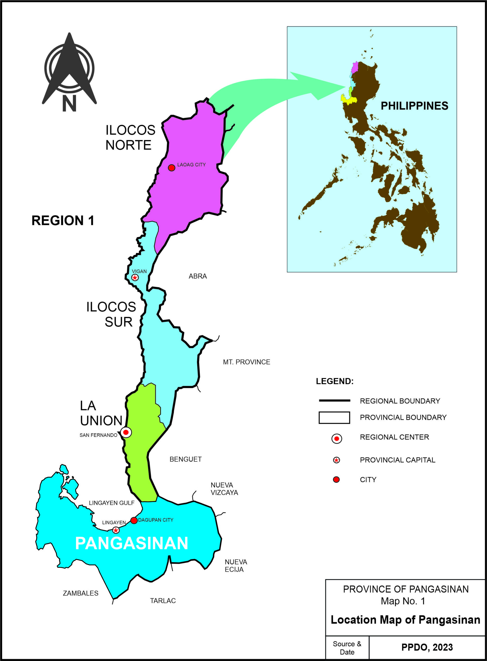
Pangasinan is considered as a major gateway to the Ilocos and Cordillera Administrative Regions. It occupies the northern portion of the central plains of Luzon with an east-west configuration that extends into a peninsular form jutting into the South China Sea. It is bounded in the North by the Lingayen Gulf, La Union and Benguet, Nueva Vizcaya in the Northeast, Nueva Ecija in the East, Tarlac in the South, and Zambales and China Sea in the West. It is about 170 kilometers north of Manila and about -59 kilometers southwest of Baguio City.
Political Boundaries
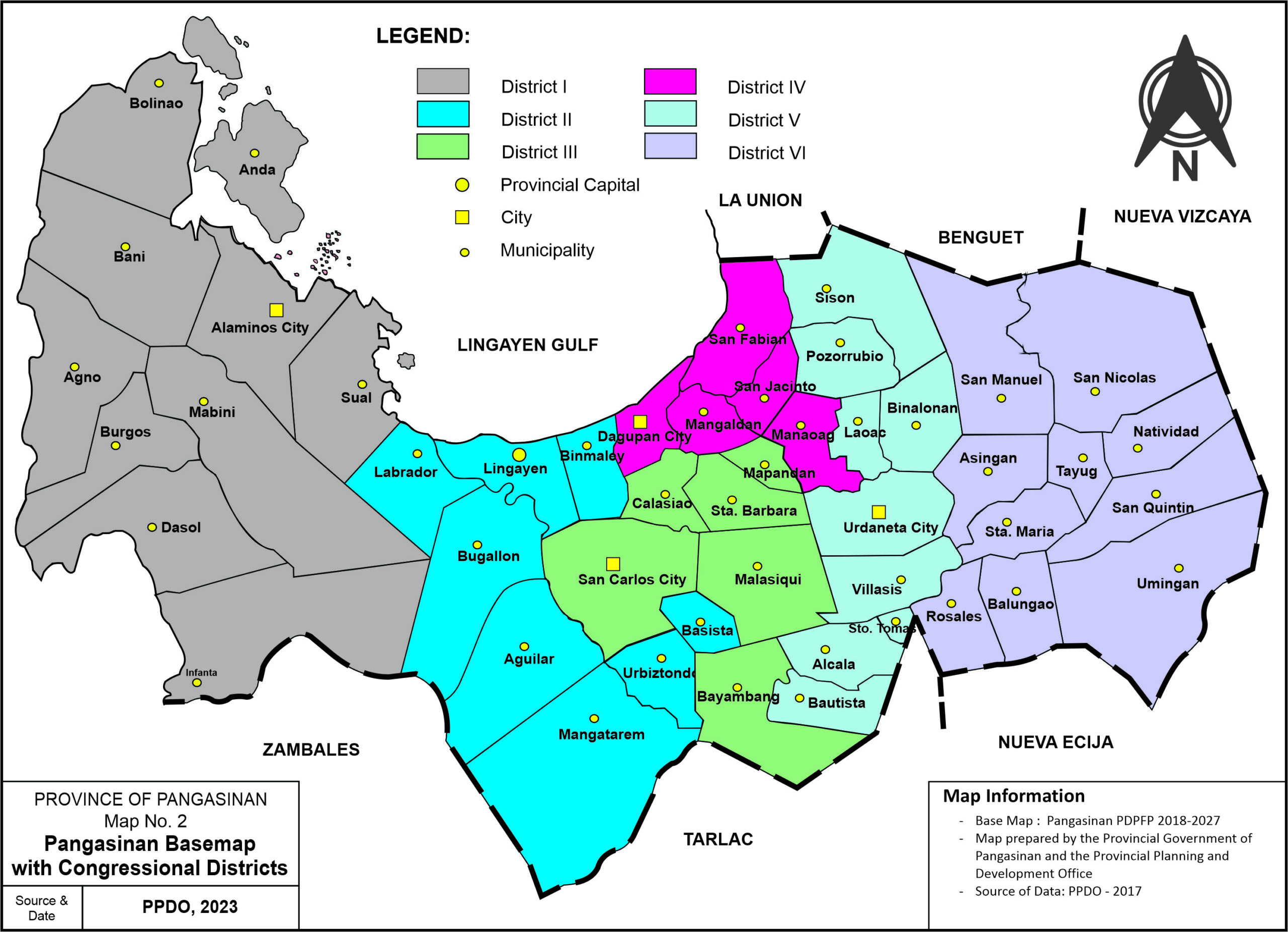
Pangasinan is comprised of 44 municipalities, 4 cities and 1,364 barangays. It has six (6) Congressional Districts with Lingayen as the Provincial Capital.
Topography / Slope
The province’s land area is generally level to undulating to rolling with the hilly and mountainous portions concentrated in the western and eastern part.
It’s slope is categorized into six (6) groups, namely: 0-3% or the level to nearly level lands; 3-8% or the gently sloping to undulating; 8-18% or the undulating to rolling lands; 18-30% or the rolling to moderately steep areas; 30-50% slope or the steep hills and mountainous areas, and; more than 50% slope or the very steep and extremely rough mountainous areas.
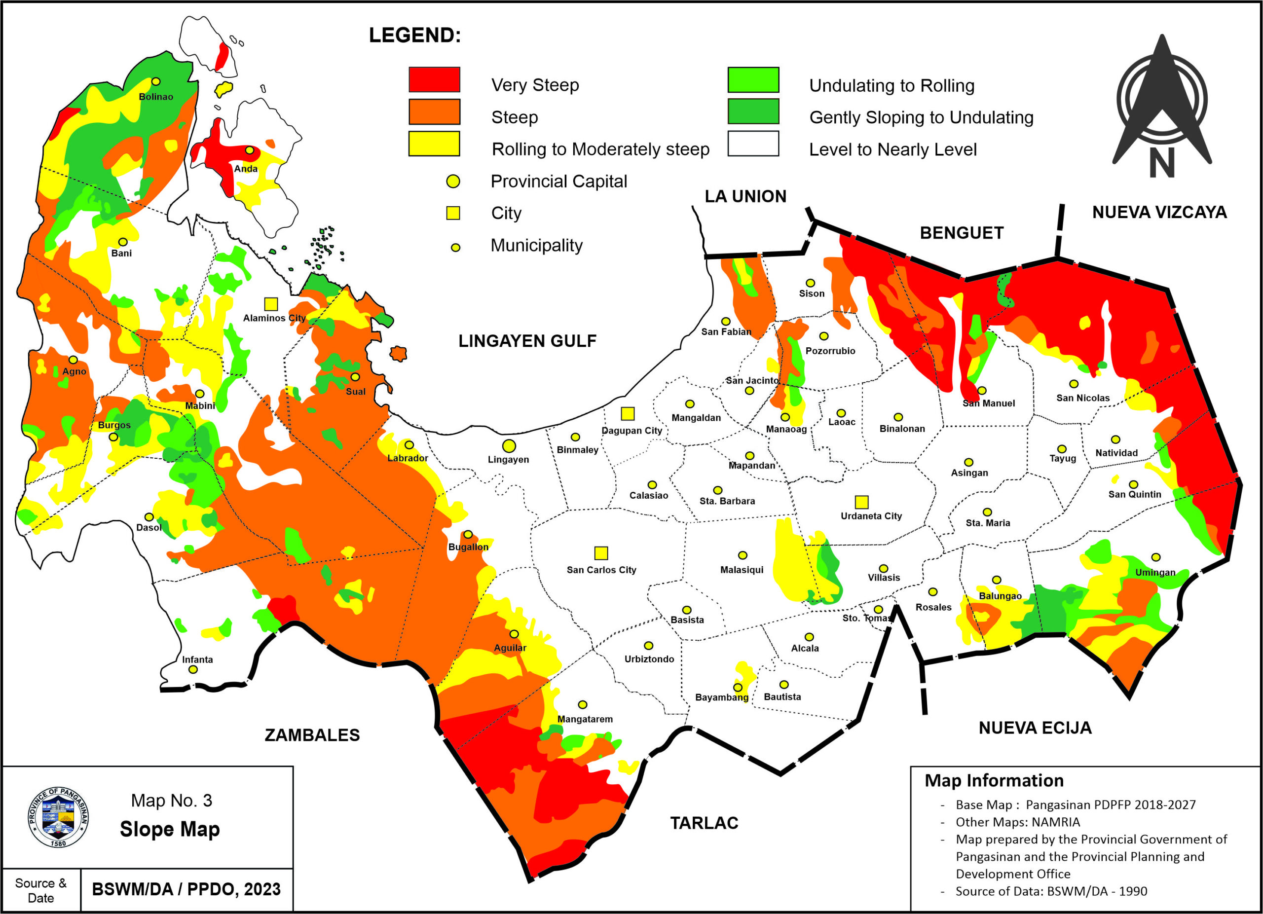
In terms of elevation, the very low areas comprise those with <100 MASL while, those with 1,000-2,000 MASL are considered under high lands.
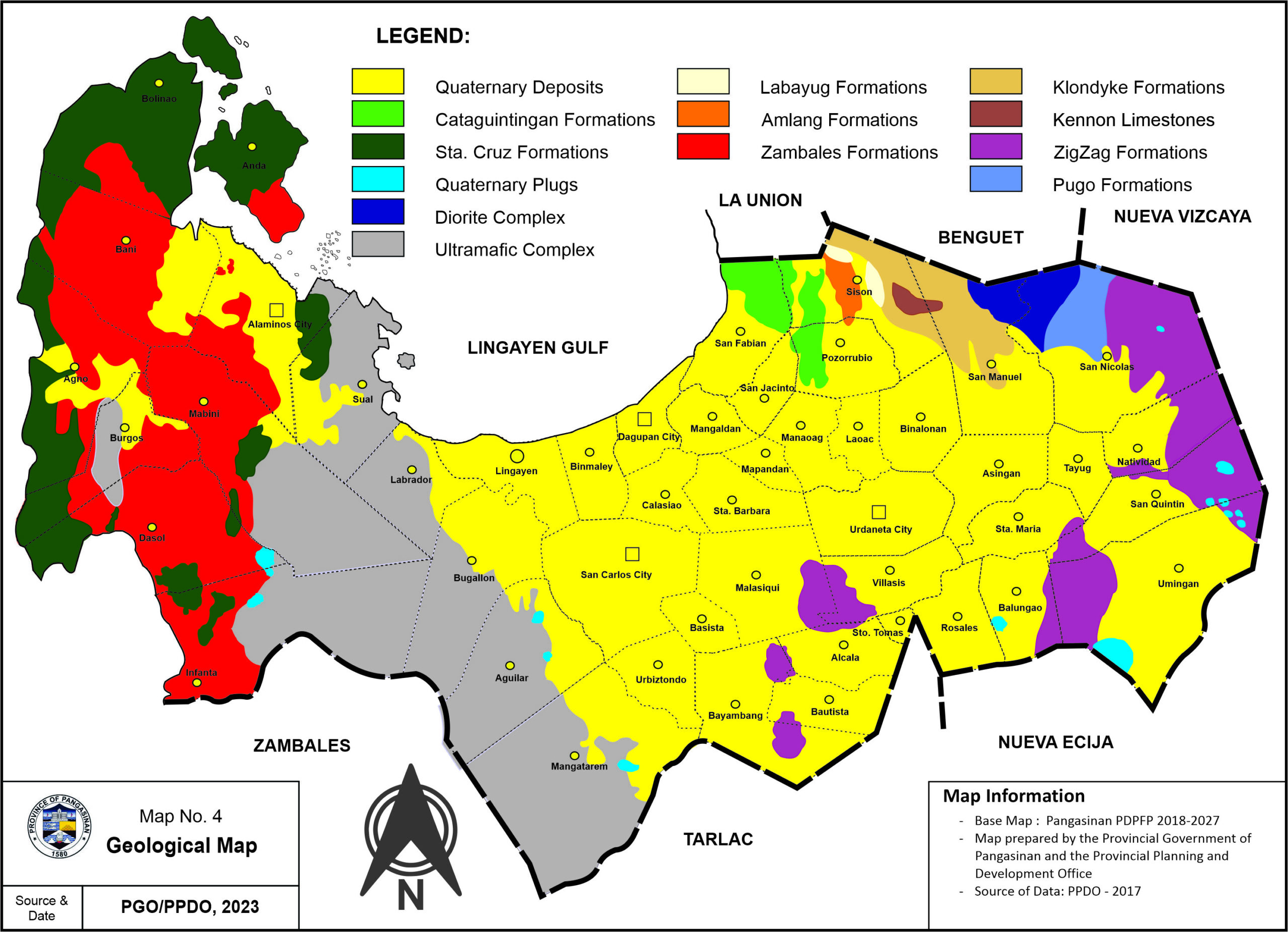
Geologic Features
The province is generally underlain by thirteen (13) distinct rock formations, which set limitations of varying degrees to land development particularly to horizontal and vertical structures, to wit:
- Quarternary Deposits – consist of detrital rock fragments varying in size from clay to boulders and occupies the river channels and flood plains;
- Cataguintingan Formations – consist of thinly bedded sedimentary rocks of shale, siltstone, sandstone and conglomerate, situated within San Fabian, Sison and Pozorrubio;
- Cruz Formation – consist of thinly to moderately thick beds of coralline limestone, mostly along the coast of Western Pangasinan;
- Zambales Formation – consist of thin and moderately thick shale, siltstone, sandstone and conglomerate mostly in the western part;
- Zigzag Limestone – consist of interbedded shale, siltstone, sandstone and conglomerate with intercalations of andesitic and basaltic volcanic, which are mostly situated in the eastern part of the province;
- Quarternary Plugs – consist of andesite and dacite plugs found in some parts of Balungao and Umingan Towns;
- Ultramafic Complex – consists of peridotite with minerals of pyroxene and occasional olivine, usually observed in the western part;
The Labayug, Amlang, Klondyke, Pugo, Diorite Complex and the Kennon Limestone formations, which occupies the least area and are observed in the northeast boundaries of the Province of Benguet.
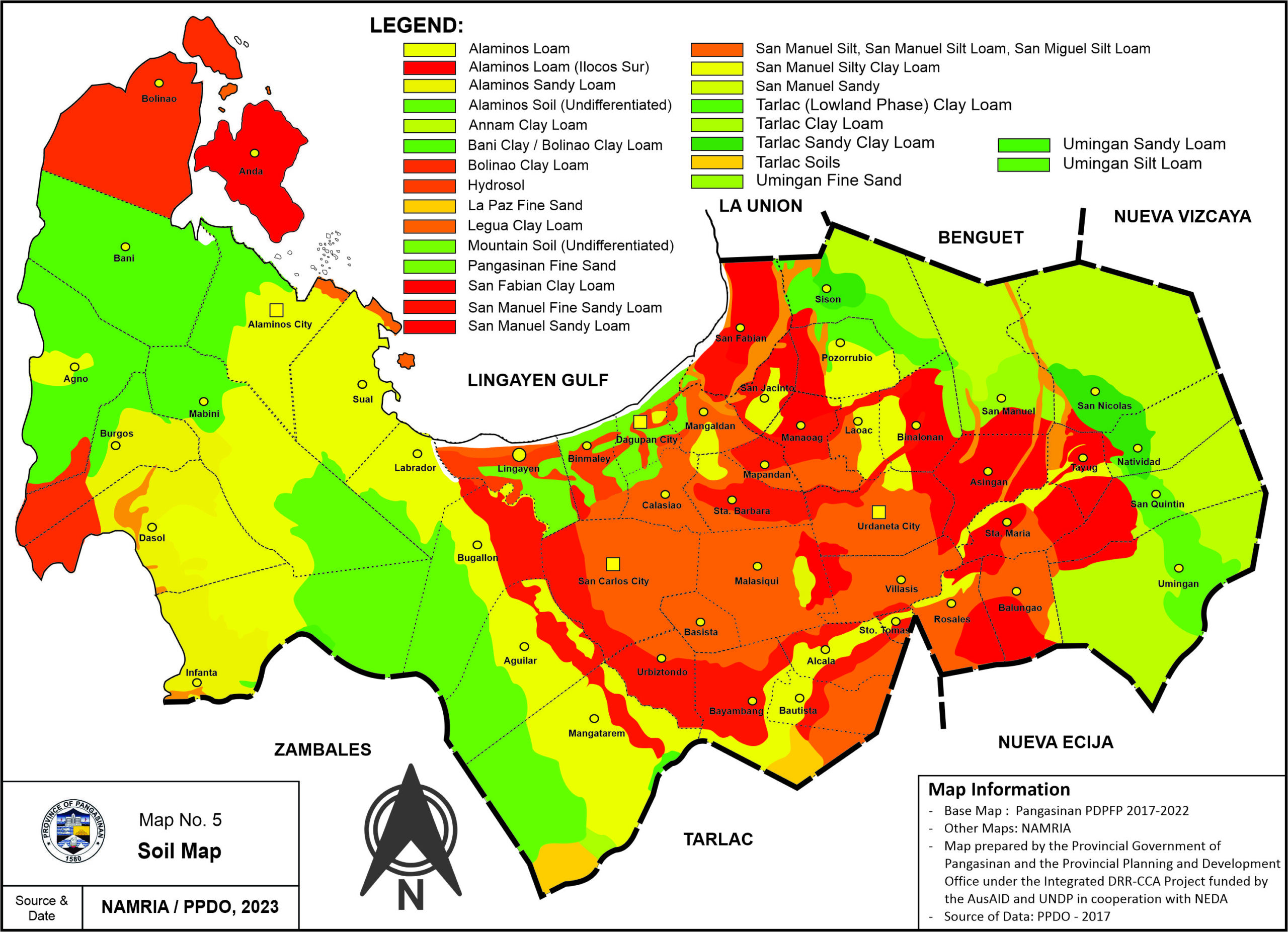
On the province soil types, the mountains of the eastern and western parts of the province consist mostly of various types of clay loam, while the soils along the rivers, especially the Agno River and its tributaries, is made up mostly of Fine Sandy Loam, Fine Sand and River Sand.
Land Resources
Pangasinan covers a land area of 545,059 hectares, which constitutes almost one-half (42%) of the total land area of Region I (1,296,462 has.) and 1.8% of the total Philippine area (30,000,000 has). Among the six (6) congressional districts, District 1 has the biggest coverage (32.27%) in terms of land area, while District 4 has the least, with 4.90% of the total provincial area.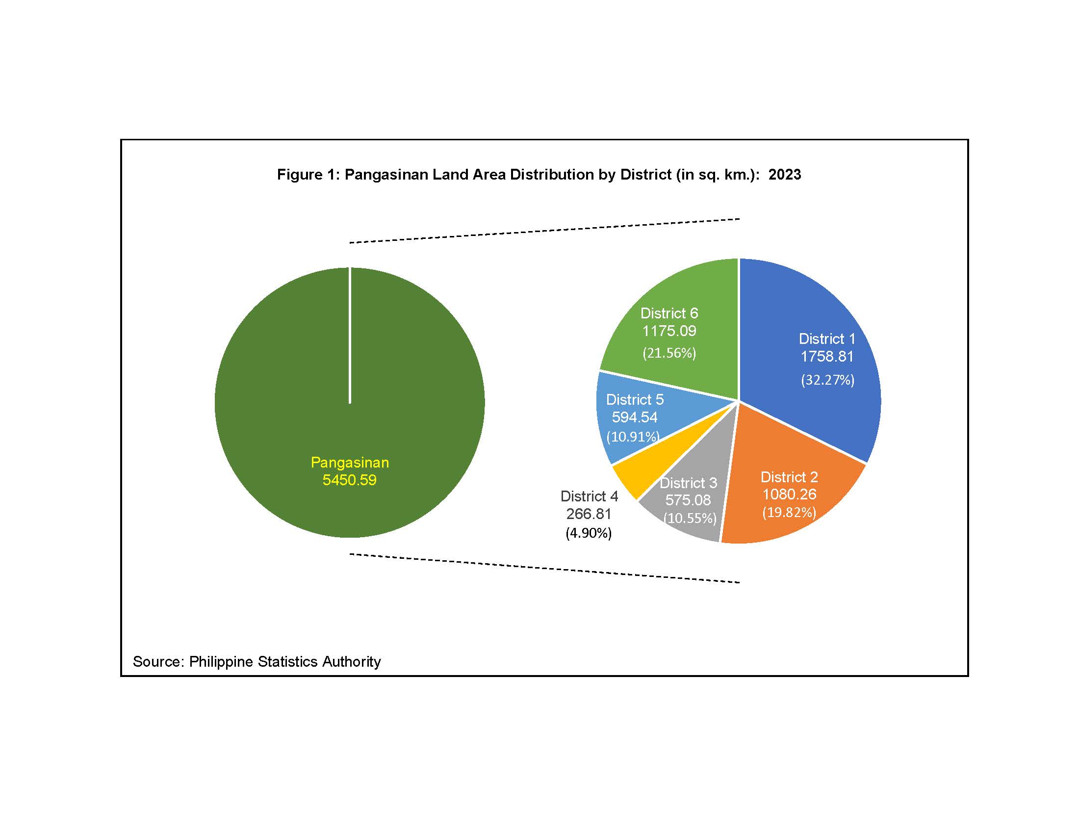
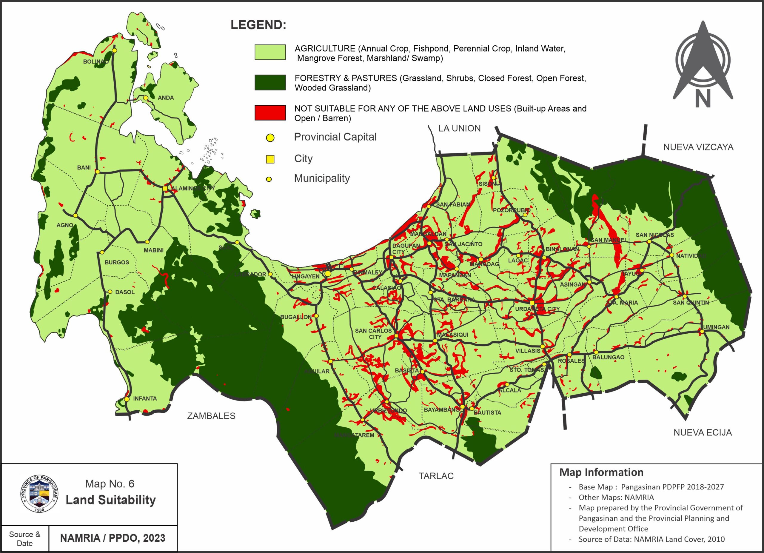
Major land area of the province is most suited to agriculture, which is mostly located in the Central and Eastern part and some portion along the coastal areas of Western Pangasinan. Areas suitable for forestry and pastures are mostly situated in the mountainous areas in the eastern and western part.
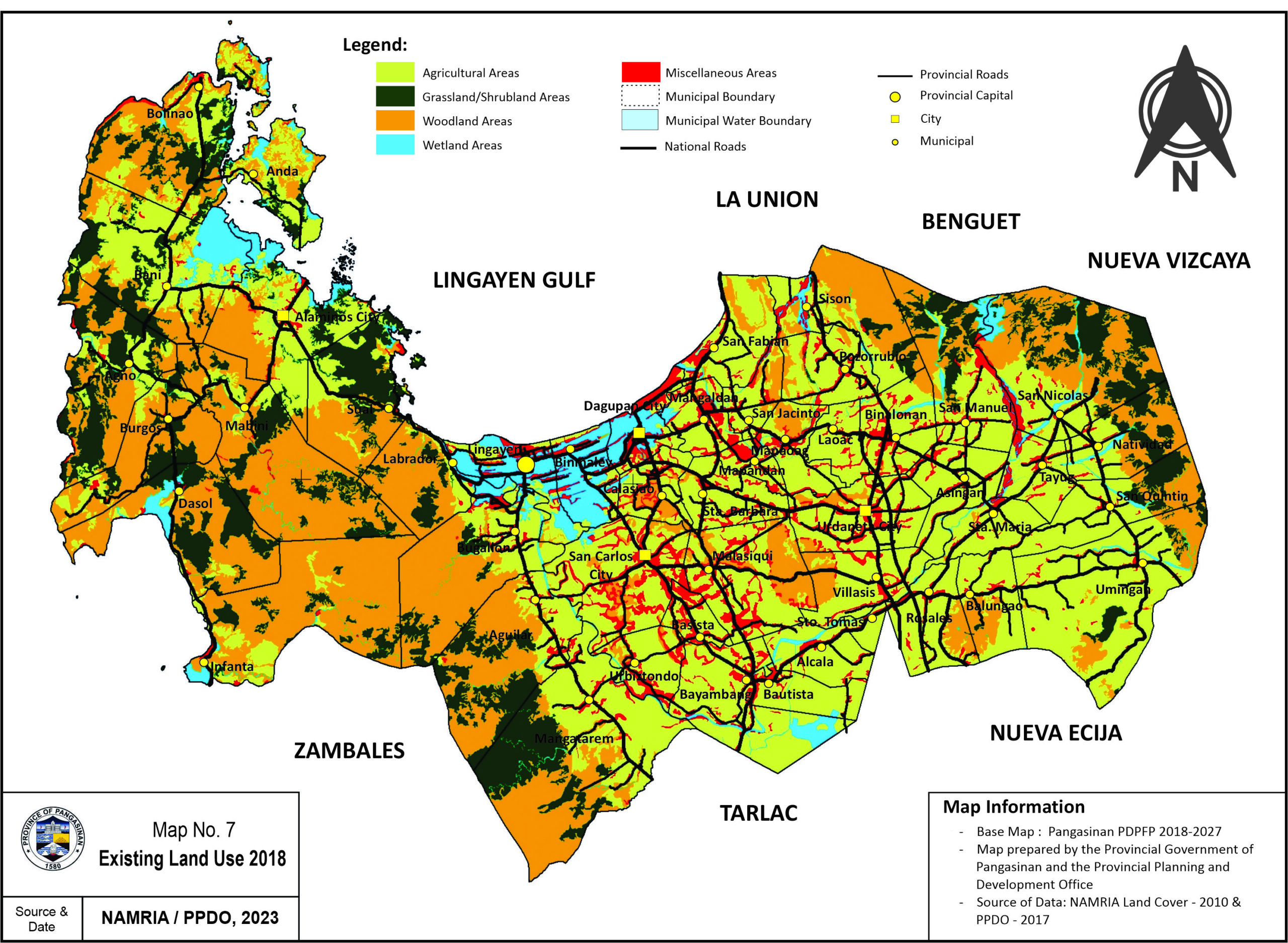
The existing land use of the province is dominated by agriculture, which is mostly situated in the Central and Eastern Pangasinan and the coastal areas of Western Pangasinan. Other land uses include grassland/shrubland, woodland, wetland and miscellaneous areas.
Mineral Resources
Pangasinan is endowed with vast deposits of mineral resources, both metallic and non-metallic, such as chromite, copper ore, limestone, shale, silica, clay, bentonite, zeolite, asbestos, gabbro, rock phosphate, and the best industrial grade sand and gravel lying largely untapped within its vast mountains and major river basins.
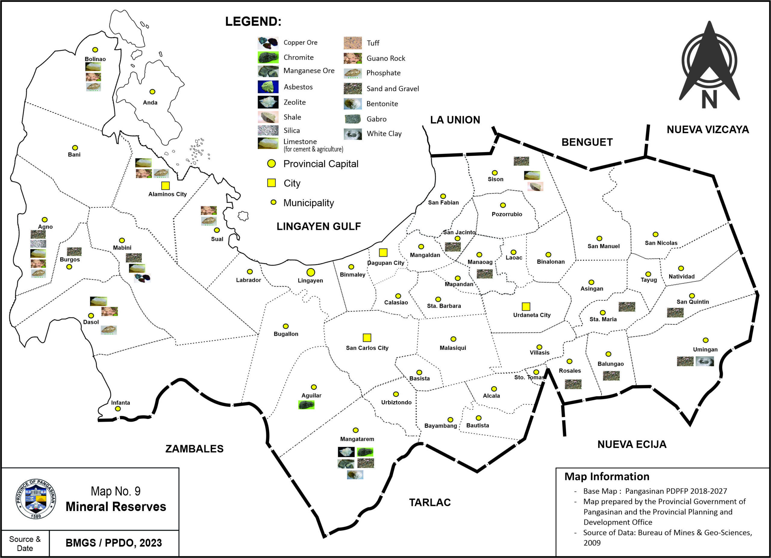
Based on the latest data from the DENR-MGB, the mineral resources for both metallic and non-metallic have an estimated volume reserve/resource of 3.7 billion metric tons and 232,919,279.12 cubic meters. For CY 2022, the total production for sand & gravel is estimated at 1,957,561.37 metric tons, while the production for the other minerals is recorded at 2,795,371.57 metric tons and 75,281,317.14 bags for clinker and cement. The total value of mineral production is Php 1,278,535,488.05 with sand & gravel having the highest value of Php 620,083,560.97.
Coastal Resources
The coastal areas of Pangasinan, especially the Lingayen Gulf, are a rich and major fishing ground in Northern Luzon. It encompasses a total length of 285.66 linear kilometers which is about 40.34% of the region’s total length of coastline (708.165 kms) and 0.80% of the Philippine coastline (36,289 kms).
The province has fourteen (14) coastal municipalities/cities comprising of 123 barangays, with the Municipality of Anda having the longest coastline covering an approximately 55.794 kms or about 19.53% of the total province’s coastline.
The total existing developed mangrove area covers about 859.6403 hectares and 263.69 linear kilometers, while the potential mangrove area comprises about 118.95 hectares and 145.76 linear kilometres. The Municipality of Bolinao has the largest existing/developed mangrove area covering approximately 167.5 hectares, followed by Dasol with 143.066 hectares.
The province also has twenty-eight (28) fish sanctuaries / marine protected areas with a total area of 2,995.17 hectares and 5.0 kilometers, including the new MPA at Macalang in Dasol, and the proposed fish sanctuaries at Buenlag in Binmaley, and Baybay Norte and Cabalitian in Sual. Likewise, some thirty-seven (37) sites for artificial reefs/payao are positioned along the coastal areas of the province.
Freshwater Resources
Ground Water is the principal source of water supply for household consumption in the province, which comes primarily from the headwater and tributaries of the Agno River.
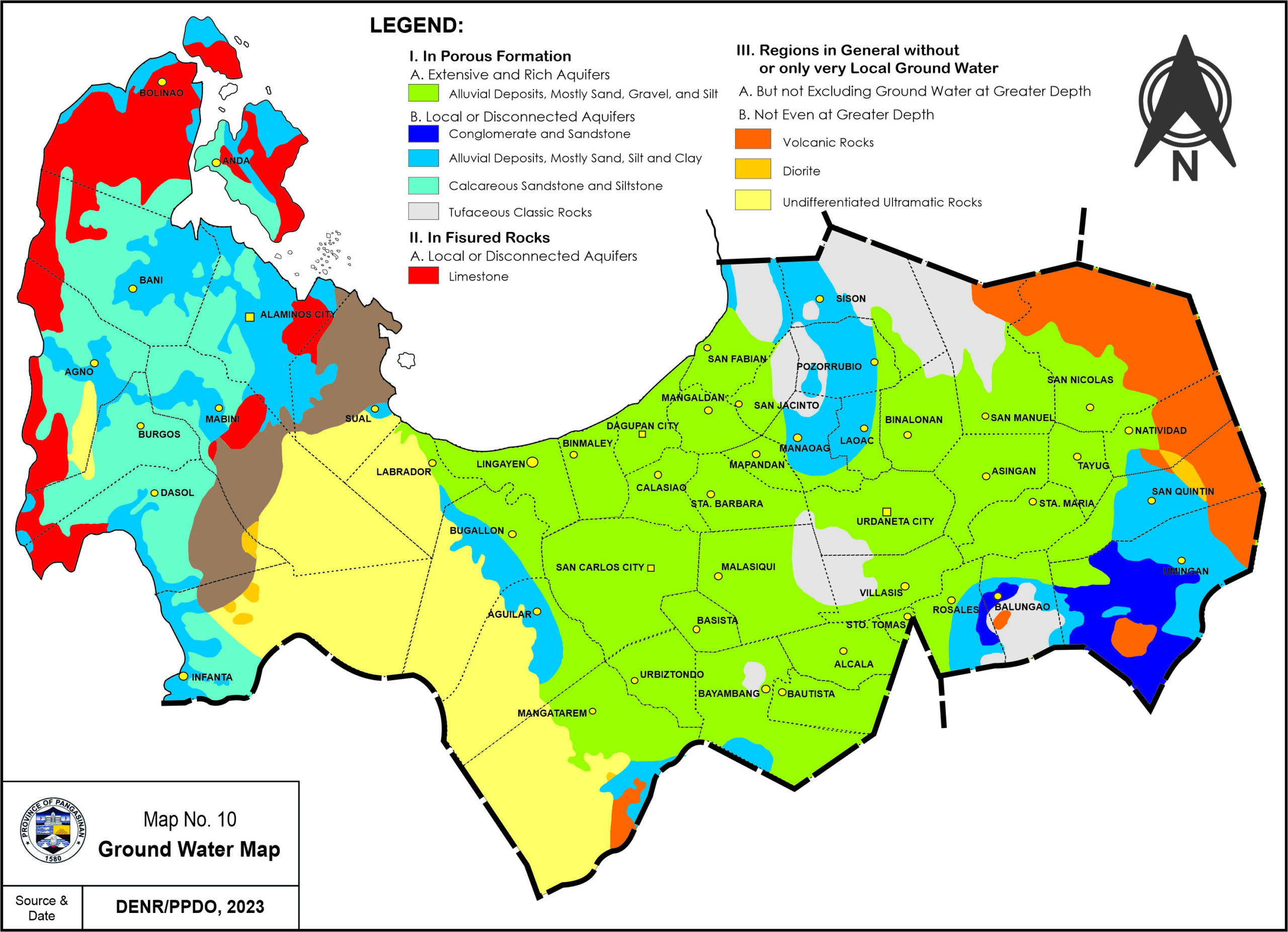
Pangasinan has confined aquifers (artesian type) that can be tapped for potable water. Such aquifers are bounded by clay formations and are composed of water-bearing materials ranging from fine to coarse sand and pebbles. Aquifers in the central part and along coastal plains consist mainly of coarse to fine siliceous sand, fine quartz and adesite sand. In the western portion, aquifers consist principally of coarse basaltic sand, basalt pebbles and pebble gravel. These are recharged by several creeks and streams as well as by rainfall in their outcrop areas in the Sierra Madre Mountain.
The province is drained by nine (9) major river systems, the longest of which is the Agno River having a length of about 270 kilometers.
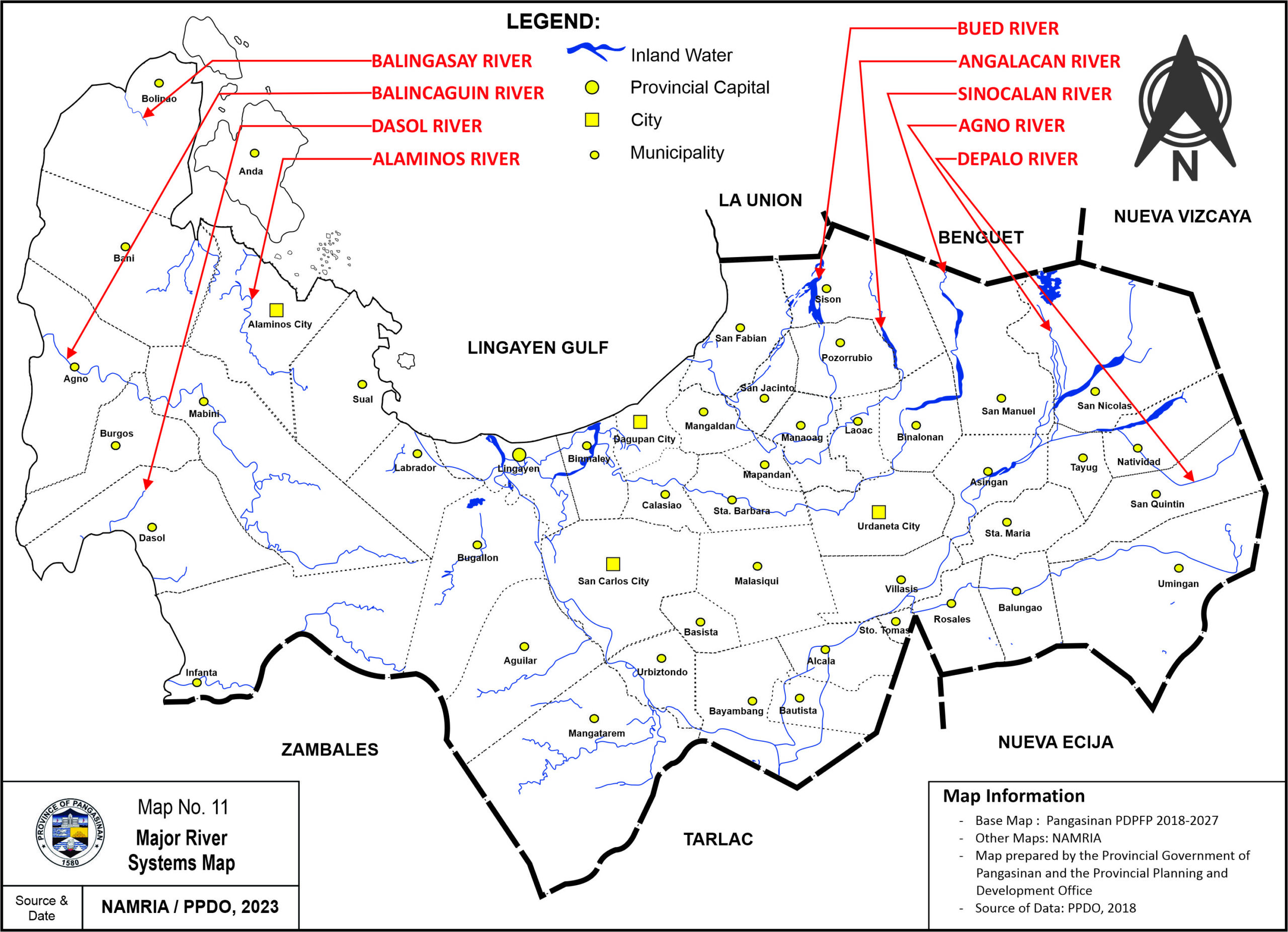
The Agno River Basin, having an area of 5,952 sq.kms., is one of the biggest watershed areas in Region I that is a valuable source of water supply for irrigation and aquaculture purposes.
Climate
The province has a tropical climate dominated by a wet or rainy season and dry season. The average annual rainfall is 223.04 millimeters, with the month of July having the highest amount of 716.4 millimeters.
The average annual temperature is 33.50C, with the month of May having the hottest with a temperature reading of 34.40C, while the coldest month was in January having a temperature of 22.00 The average relative humidity is 77%.
For the year in review, a total of twelve (12) tropical cyclones were observed to have hit the province, with the months of July and August recorded the highest with three (3) tropical cyclones in each month.
Natural Hazards / Constraints
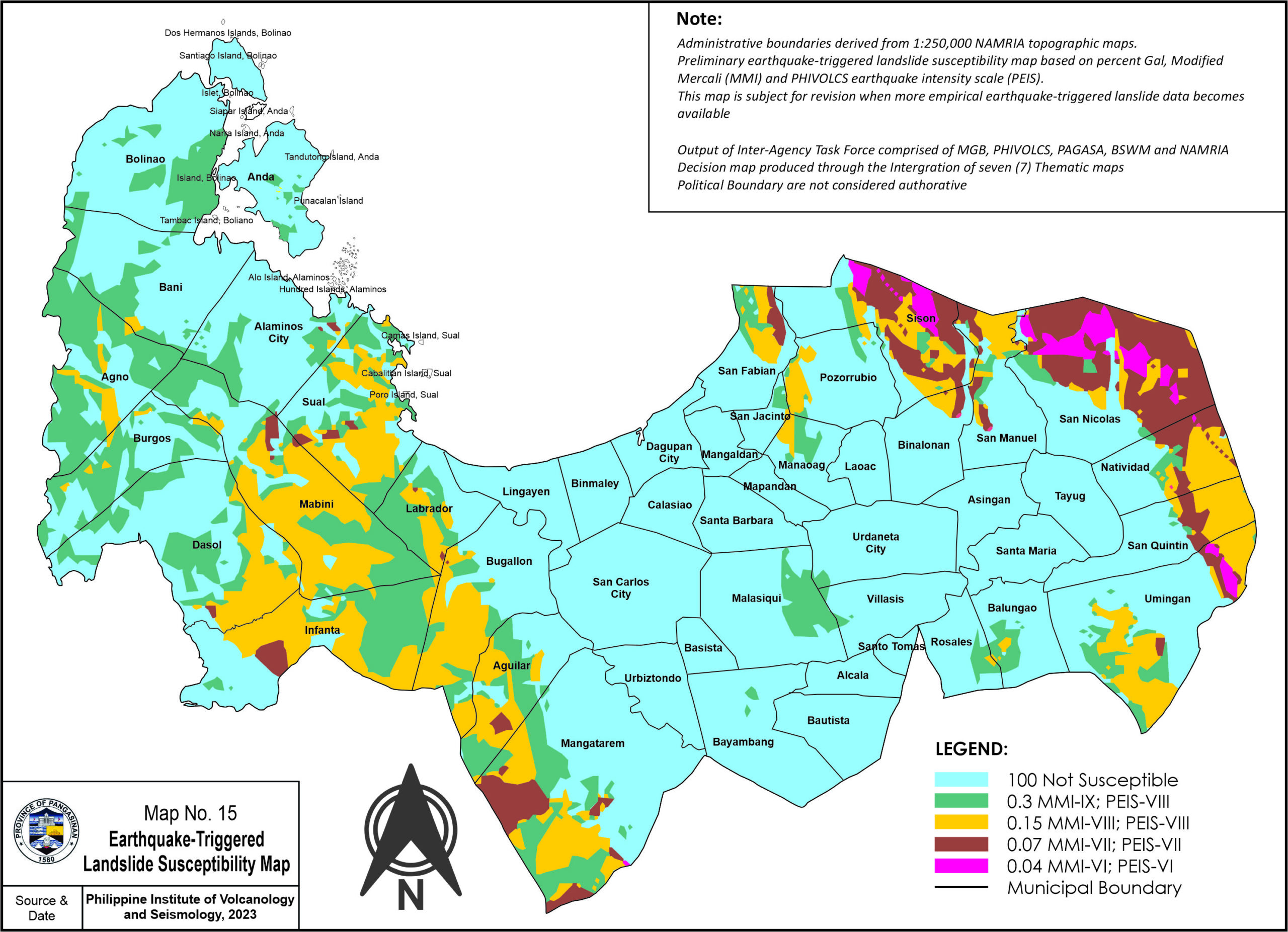
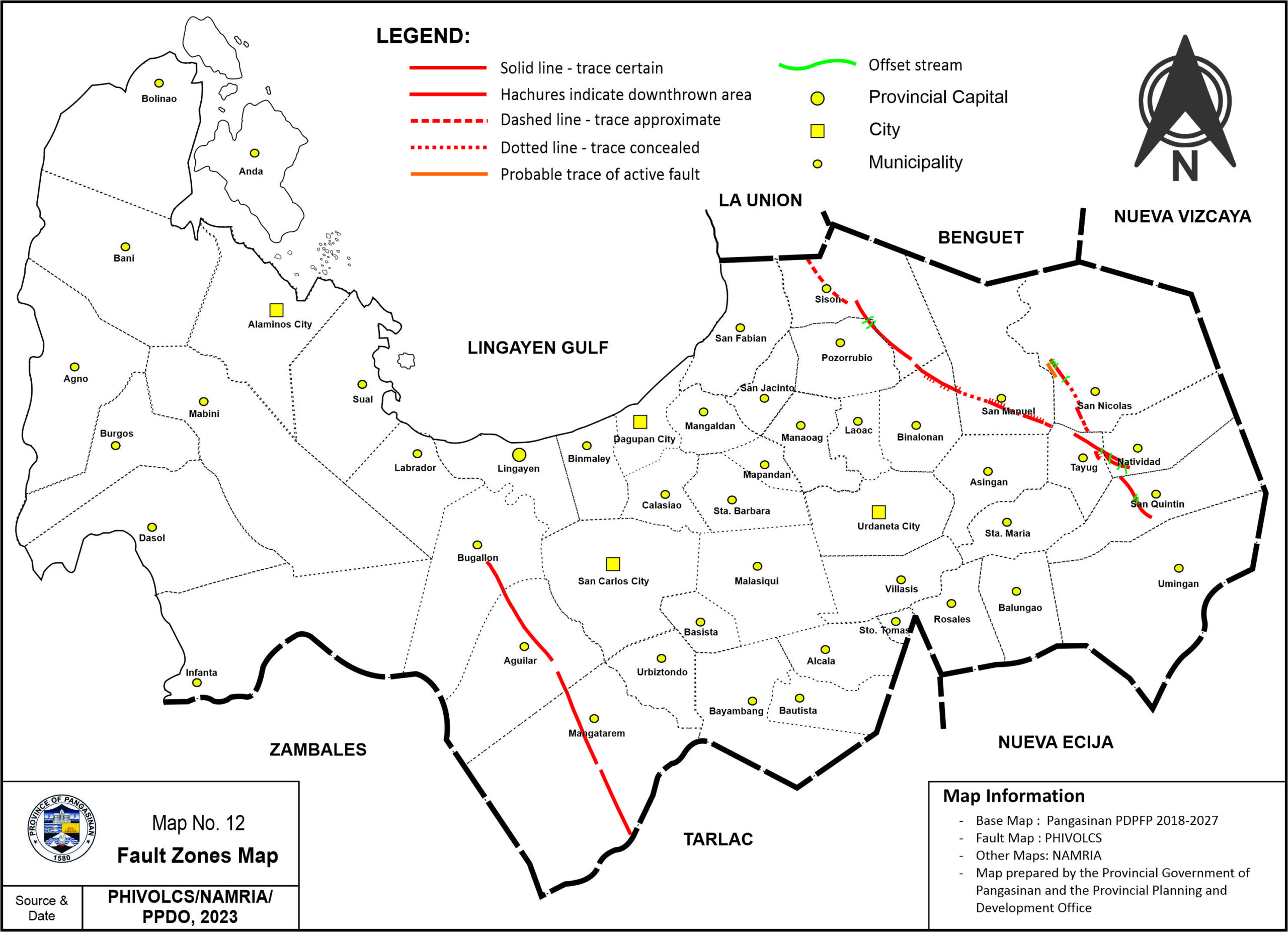
The province is traversed by numerous active faults thereby placing under constant strain and pressure resulting from rock displacement and earthquake. As shown in, the solid lines, denotes that the trace of the fault is already certain and is evident at the normal fault along the Labrador to San Clemente, Tarlac fault line. On the other hand, the dashed line as seen on the Pozorrubio to Umingan left lateral fault and the San Quintin to San Nicolas normal fault denotes that the traces of the fault are approximate.
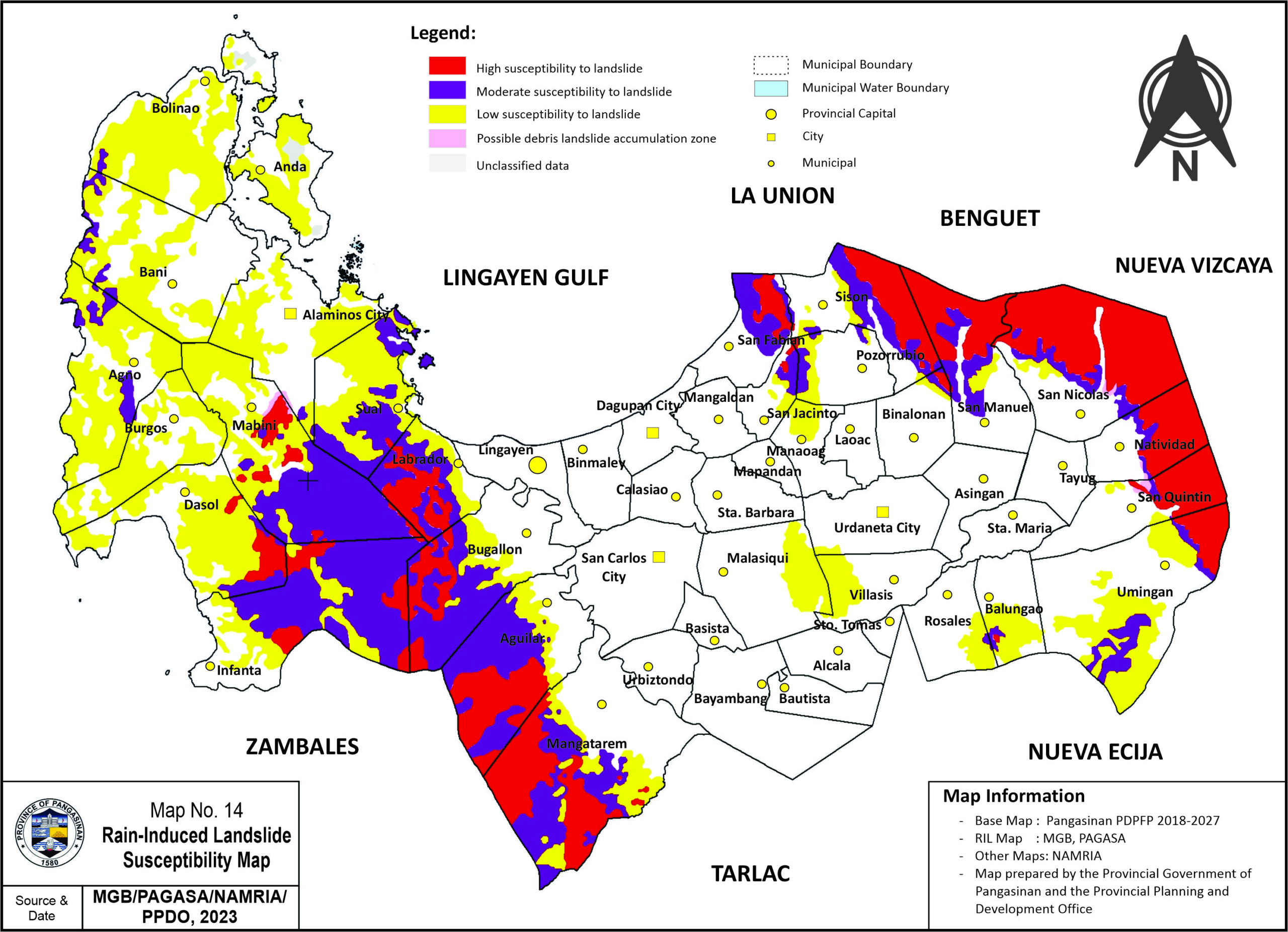
Areas traversed by the major rivers, mostly in central and eastern part and some coastal areas in the west are susceptible to flooding and storm surge, while areas prone to landslide and severe erosion are mostly situated in the mountainous areas of Western and Eastern Pangasinan.
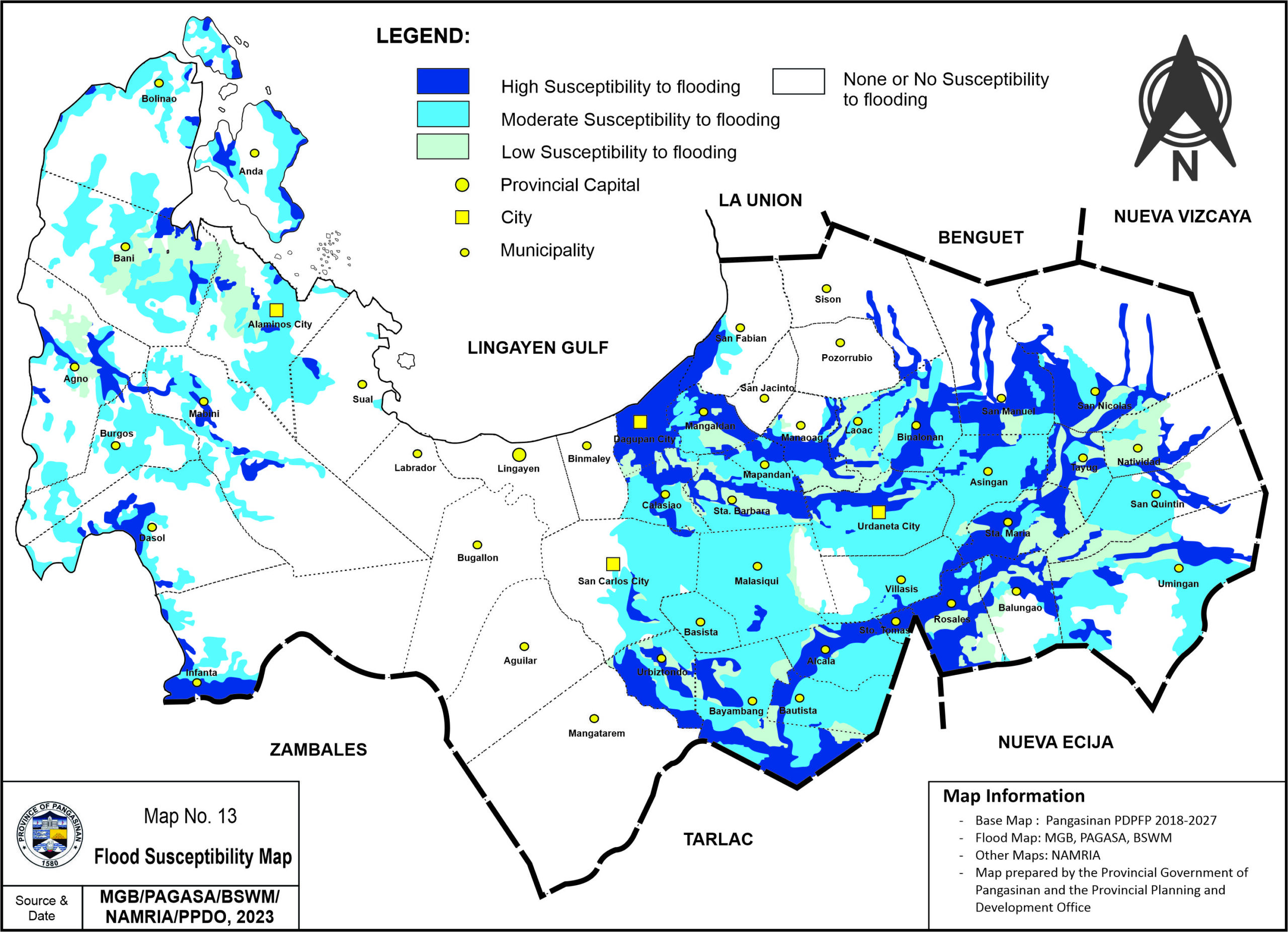
In the Landslide Susceptibility Maps, the highly susceptible areas for rain-induced, and earthquake-triggered landslide are located in the mountainous areas of the province, mostly in the eastern and western part.